Winter Park Ski Shop

Regions

Browse Subtopics

Regions Articles

Church Park
Church Park

George Henry Church and his brother John had a substantial ranch in Jefferson Country, prior to Colorado Statehood.  When the Timber and Stone Act of 1878 was passed, it permitted the purchase of land unfit for agriculture for $2.50 an acre.  Thus the Church brothers obtained land in Middle Park for summer grazing.  They would move their cattle into the Park by driving them over the Rollins Pass.   The area they used is just west of the town of Fraser and became known as Church Park.

In 1910, the Church Ditch was created to divert water across the Continental Divide for irrigation.  The remains of this early trans-mountain project can still be seen today at mile marker 241.5 on U.S. Highway 40.

Fraser Valley
Fraser Valley

The principal population centers in the Fraser River Valley are Winter Park, Fraser and Tabernash.  When the early stage coaches came over Berthoud pass into the Fraser Valley, the most popular stop was at the Cozens Ranch, which now houses a historical museum in Winter Park. The valley is now bisected by U.S. Highway 40, which was designated the "Victory Highway" in 1931.  The new route of the highway leads through the main streets in both Fraser and Tabernash and the backdoors of some business became front doors because of the new highway alignment.   

Tabernash was the name given to a railroad siding, named for the Ute leader who was killed during a confrontation with local ranchers.  The town became a key station on the railroad line, and included a roundhouse, and a supply of helper engines for the steep climb over Rollins Pass.  When the Moffatt Tunnel was opened in 1928, the railroad no longer needed service there and the town lost its' main economic support.

George Easton founded the town site of Fraser in 1905.  The rest of the country became familiar with Fraser when the winter temperatures were often the lowest recorded in the U.S. and Fraser was know by the nickname "Icebox of the Nation".   Lumbering was one of the prime industries in the region until World War II.  During the war, the military built a Prisoner of War camp at Fraser to help lumber for the mills in the area.

The current area of Winter Park has had many names over the years.  First it was called simply "Old Town" or "Vasquez", named after the fur trader Louis Vasquez.  "Woodspur" or "Woodstock" referred to Billy Wood's lumber mill in the area, which furnished ties for the railroad while it was being built over Rollins Pass. During the construction of the Moffatt Tunnel, the name "West Portal" came into usage.  Rail workers also called the community "Little Chicago" as it was as it was a favorite gambling, saloon, and brothel site.  As tourists began to arrive it was known as "Idlewild" and also "Hideaway Park".  Finally, the name "Winter Park" was settled upon to correspond with the adjacent ski area of the same name.

The area population declined from 1232 people in the 1920's to only 373 people by 1930.  The Great Depression ended the construction boom and the price of beef became too low for ranches to turn a profit.  However, since that time, the area has thrived, mostly based on a tourism economy.  The valley's main source of income is now recreation and second home construction. 

Grand County
Grand County

Grand County was established in 1874 by the Territory of Colorado, thus becoming a county two years before Colorado became a state. It was named for the Grand River, the name by which the Colorado River was known at that time. The headwaters of the today’s Colorado River are in Grand County. The county was formed from a portion of Summit County but acquired its current boundaries in 1877, when part of the Grand County was used to create Routt County. The county seat is Hot Sulphur Springs. The area of 1,854 square miles consists of meadows, river valleys and mountains.

Grand County Time Line

Prehistoric
7000 BCE to 900 BCE: Paleo Indians  (Yarmony, Rollins Pass, Windy Gap) use Middle Park as summer hunting area

1819 – 1860
1819:Adams-Onis Treaty – Middle Park partitioned – Sites of Granby, Fraser, Grand Lake and Hot Sulphur are in the U.S, Kremmling still part of Spain

Middle Park well known to “Mountain Men” by 1820

1828: Kremmling becomes part of Texas

1837: T.J. Farnham’s expedition crosses the Blue at Grand River

1839: Grand River named on a semi-official map

1842: Rufus B. Sage visit

1844: Captain John C. Fremont’s second expedition, accompanied by Kit Carson, enters Middle Park over Muddy Pass and exits up the Blue River

1854: Sir St. George Gore, an Englishmen, accompanied by Jim Bridger enters Middle Park for hunting expedition

1859: First appearance of prospectors; interest in Hot Sulphur Springs

1861 – 1874
1861: Berthoud crosses Berthoud Pass and traverses Middle Park

1861: Middle Park becomes part of Summit County

1863: Trouble begins between the Utes and white men

1864-1868: Wm. N. Byers acquires Hot Sulphur Springs

1866: Gov. Cummings signs Treaty of Middle Park

1868: John Wesley Powell visits Grand Lake, makes first recorded ascent of Longs Peak

1867: Joseph Westcott settles at Grand Lake

1871-1872: Clarence King surveys area

1873-1874:  F.V. Hayden surveys area

1874: Creation of Grand County (two years before Colorado became a state)

1874: Toll roads opens over Rollins and Berthoud Passes

1874: William H. Jackson, renowned photographer, takes first photographs of Middle Park

1875 – 1888
1875: First mail routes to Hot Sulphur Springs

1875: Silver ore indications in Never Summer Range

1875: First school opens in Hot Sulphur Springs with 12 students, (school “year” was 20 days)

1877: Routt County detached from Grand County

1877: Stokes-Dean political crisis

1878: Tabernash and Abraham Elliott killed

1879: Ute Indian War produces excitement, anxiety

1879: Lulu City & Teller City formed

1880: Gaskill City formed

1881: Four railroad projects frustrated

1881: County Seat moves to Grand Lake, height of mining boom,   Grand Lake Prospector is launched

1883: Commissioner shootings at Grand Lake

1884: Shooting of Texas Charlie in Hot Sulphur Springs

1884: Kremmling formed

1885: Kremmling Post Office opens

1885-1886: Collapse of mining, North Park separates from Grand County

1888: County Seat moves back to Hot Sulphur Springs

1889 – 1904
Expansion of ranching

Development of public education

1890: Grand Ditch construction begins... carries water from Grand Lake mountains to the front range

1891: First platting of Kremmling

1891: Berthoud Pass route becomes state road

1893: Construction begins on Byers Canyon road

1896 et seq.: Organized religious congregations develop

1892: First diversion of water to eastern slope

1898: First high school opens in Kremmling

1902-1904:  Moffat – Harriman struggle

1903: Hot Sulphur Springs incorporates

1904: Kremmling incorporates

1904: Moffat Road crosses Rollins Pass

1904: First motor car arrives Grand County

1904: First telephones installed

1905 – 1914
1905: First Forest Reserves

1905: Fraser develops, Granby is founded

1905: Moffat Road reaches Hot Sulphur Springs

1905: Parshall is founded

1906: Moffat Road reaches Kremmling

Proliferation of competitive newspapers

1905-1908: Heyday of Monarch

1908: Arapaho National Forest established

1911: First Hot Sulphur Springs Winter Carnival

1912: First Middle Park Fair

1913: Eleven motor vehicles are registered in Grand County

1913: Tabernash established as railroad division point

1915 – 1930
1915: Rocky Mountain National Park founded

1917-1918: Participation in World War I by 151 Grand County residents

1918-1919: Influenza epidemic

1919: Grand County Pioneer Society founded

1919: Fall River Road completed

1921: Grand River name changed to Colorado River by U.S. Congress

1922: First radio receiver

1923: Gore Pass opens to motor vehicles

1923: Improved Berthoud Pass road opens

1923-1928: Moffat Tunnel built

1926: Fred Selak murder

1929-1941: The Great Depression

1930-1932: Berthoud kept open all winter

1932: Trail Ridge Road completed

Since 1930
1938: Colorado-Big Thompson irrigation and power project begins

1940: Winter Park Ski Area opens

1941-1945: Participation in WWII

Late 1940s – early 1950s: Construction of Colorado– Big Thompson Project

1947: Adams Tunnel in operation

Growth, then boom, of winter sports


Grand County Trivia
Grand County Trivia

After 1879 there were no Native Americans in Grand County.

In the 1800, the leading cause of death in Grand County was accidents followed by pneumonia.

Between 1887 and 1902, Grand County had no divorces.

The total resident population of Grand County in 1900 was 741.  The average life expectancy was 47 years.

Winters in Grand County often were severe, but nothing as terrible as the winter of 1898-1899.  Warm weather preceded the storm which began on February 2nd.  Four feet of snow fell by that first evening and the residents did not see the sun for the rest of the month as the snow continued to fall.  The snow continued into March and April and while few residents died, but the loss of livestock was tremendous.

Middle Park
Middle Park

Middle Park is one of three big parks in the Colorado Rockies and covers a large portion of Grand County. Like North Park and South Park on either side, Middle Park is a large open area of  meadows, river valleys, woodlands, surrounded by mountains. It is also the headwaters of the mighty Colorado River.

The first printed account of Middle Park was written in 1839 describing abundant antelope, deer, big horn sheep, bears, buffalo and elk. The word “parc” is of French origin and so it is logical to assume that French trappers named this location.

In 1819 the Adams-Onis Treaty partitioned Middle Park so that Fraser, Granby and Hot Sulphur Springs, had they existed, would become part of the United States; however, Kremmling would have belonged to Spain! Later, Kremmling would have been part of Texas.

While political boundaries have changed, the beauty of the park remains the same. As Middle Park is entirely surrounded by mountains, Robert C. Black, who wrote the area’s definitive history, chose to call his book, Island in the Rockies.

North Park & Middle Park - Politics and Whiskey

The Territorial legislature defined the boundaries and county seats for the West Slope in 1861.  Geographic knowledge of the Colorado mountains was somewhat limited at that time.  North Park (a name now synonymous with Jackson County) was an Indian hunting ground and little was known about it.

A boom started with the discovery of gold and silver at Teller City in 1879.  North Park was considered to be part of Grand County, and now there was property to assess and tax.  The Grand County road tax in North Park for 1881 applied only to males between the ages of 21 and 45.  They had to either pay $3 in cash or do two day's work on the roads. John Mills, a Teller City resident who acted as an attorney for mine owners, served as a Grand County commissioner and was one of the commissioners killed in the July 4, 1883 gun battle at Grand Lake.

As ranches became established and more mineral deposits were discovered, the Larimer County commissioners began to speculate that the "Snowy Range" that defined the western boundary of Larimer County was the Park Range on the west side of North Park rather than the Medicine Bow Range.  This opinion soon degenerated into a dispute between Grand and Larimer counties, ultimately ending up in court. In 1886 the Colorado Supreme Court ruled that North Park was part of Larimer County.

A trip to the county seat in Fort Collins was a considerable undertaking.  If everything ran on schedule it was possible for travelers to leave Walden on the morning stage, catch a train from Laramie to Cheyenne, another train from Cheyenne to Greeley, still another from Greeley to Fort Collins, and arrive at the county seat before closing hours the following day.  The fares amounted to a significant expense.  It was probably more common for a North Parker to travel to Fort Collins in his wagon, take care of business, and come home with a wagonload of provisions.  The trip by wagon took three to four days each way.

As the population of North Park grew, so did the desire to split from Larimer County.  In 1908 the Loveland newspaper stated that Larimer County was too big and advocated a new county with Loveland as the county seat.  The Walden newspaper agreed that the county was too big but felt the wrong division line had been picked, pointing out that "A Loveland man can get to the county seat in three hours anytime, but it takes a North Park man three days most of the time."

Ranchers resisted early efforts to set off the area west of the Medicine Bow Range into a county of its own as they carried the largest part of the tax burden and felt their taxes would increase if a new county was established.  But by 1908 there was general agreement within the Park that it was time for court and administrative offices to be more conveniently located.

The total valuation assessed in 1908 of North Park property by Larimer County was $771,776, which generated $16,979 of revenue.  The salaries of some of the paid officers of the new county was estimated as follows:

     Assessor                                                    $800

     County School Superintendent                   $800

     Water Commissioner, 2 districts                $1000

     County Commissioners                             $1000

Even adding in salaries for the sheriff and county clerk it appeared quite likely that the new county could be operated efficiently without a tax increase and the proposal to create "North Park County" had nearly unanimous support from North Parkers.  The bill passed the legislature easily in April 1909, with a name change to Jackson, and was quickly signed into law on May 5 by Governor Shafroth.

While North Parkers were eager to sever their legal ties to Larimer County in 1909, they clearly weren't ready to give up the pleasures of offered by a nip of the bottle.  Like most frontier areas, North Park had a significant number of single men who liked to occasionally get together and enjoy a few drinks with their friends.  Walden was the center of socialization.  According to an 1899 newspaper article, Walden residents worried about the "toughs" who came to town to "drink barbed-wire bitters and then shoot up the place."

In addition, local married men sometimes frequented the bars when they could have been spending more time at home helping out with domestic chores.  As a result, a strong temperance movement soon divided the community.  One of the two local newspapers, the North Park Union, endorsed the temperance movement in early 1902 and soon found itself the target of a boycott by both advertisers and subscribers.  Although the editor declared it a "boycott of no great magnitude", the paper had a new owner/editor within a month.  The issue of whether Walden should be wet or dry was on the 1902 ballot.  By a very decisive majority, voters decided Walden would continue to be wet.

Just before the 1906 election, the Walden newspaper criticized the local Republican Party bosses for providing a lot of free whiskey in every North Park precinct on election day, and urged North Parkers not to sell their vote for a drink.  The temperance movement enjoyed its first victory when it combined forces with the local church and convinced the businessmen of Walden to close their stores on Sundays.  The closing did not stand in high favor with ranchers.  "When a man can't buy axle grease for his wagon when it runs dry and something else for himself when he runs dry, it is time to call a halt," they declared.  Quite a number of the ranchers started going through to Laramie for their provisions, and the Sunday closing rule was abandoned six weeks after it was implemented.

When news reached Walden in early 1909 that the bill creating Jackson County had cleared the legislature, the newspaper reported that the town was moved to the point of a merry celebration.  The brass band marched, guns were fired, and at daybreak "the women, as becomes their sex, were among the few who were sober."  A few weeks later news that the Governor had signed the bill was cause for another celebration.  The newspaper reported that, "the air about town clouded up and filled with burnt powder and raucous vocalizations.  The festivities continued in the evening with flying anvils propelled by stick powder . . ." The first hundred years of Jackson County had commenced.

The Blue
The Blue

Because gold had been found at the headwaters of the Blue River at Breckenridge, hopes were high among prospectors who worked the downstream tributaries in Grand County.  However, this lower section of the Blue contained no mineral wealth. 

The Denver and Rio Grand Railroad planned to run a route through the valley and began constructing grades, but the tracks were never laid because Moffatt's railroad crossed the county first.

An enterprising Canadian, 25 year old Willis Charles Call, had been employed as a cook for the grading company in 1881.  When the railroad abandoned the project, Call became a registrar of voters, and in 1886, the county assessor.  By 1890, he had a choice ranch near Kremmling.  His Austrian wife, Mary Rohrocher, was a very popular hostess.  It is believed that they owned the first automobile in the county.

The conflicts between the white settles and Ute Indians came to a climax in 1878 when the Ute leader Tabernash was killed by a posse and the very next day, Abraham Elliott a homesteader on the Blue, was killed in retaliation.  The remains of his ranch can be seen on Highway 9 at mile marker 135. 

Across the river was the ranch of Henry Yust, who settled there in 1885.  Another early ranching family was that of Thomas Pharo, An Englishman from Franham in Surry, near London.  Settling there in 1880, he developed a major cattle and horse ranch. 

The Blue River area was connected with a route west in 1913, when the co-called Trough Road was constructed, beside the Gore Canyon to State Bridge.

The Muddy
The Muddy

The Muddy Creek Valley, on the western edge of Grand County, has a rich history, mostly based on ranching. It became something of a multi-cultural region, attracting French, Greek, Belgian, British, Dutch, Austrian, Swiss, German and Jewish settlers.  There were also dozens of homesteading families that came from eastern Colorado and Mid-West America.

The known prehistory of the Muddy Creek area extends back 10,000 years at a kill site for bison on Twin Peaks, which separates the Muddy from the Troublesome Creek drainages. 

Among the early settlers in the region were the Ed Pinney family who has a ranch near the summit of Gore Pass.  As the boundary between Grand and Routt County was not well defined, Ed paid his taxes to whichever county had the lowest rate in any given year.  After the railroad arrived at Kremmling, a stage coach route to Topanos, west of Gore Pass, was started.  At first the Pinney Ranch was designated a lunch stop, and then an overnight stop.  In 1906, the Pinneys' built a big house that could accommodate up to 40 people, two to a room.

One of the many notable ranches was that of Fred and Myrtle DeBerard.  Their Park Ranch included 20,000 acres, and they ran over 1600 registered Herefords.  Fred was instrumental in the creation of four reservoirs in the region.

Another prominent early rancher was Frenchman Alfred Argualer, who first came to hunt the region but returned to establish the May-Be-So Ranch.  He continued developing properties from 1880 until 1911 when he sold his ranch on the Muddy to Nick "Turk" Constantine.

A significant rancher of the 20th century was Walter "Wad" Hinnan, who served form 1966-7 as President of the Colorado Cattlemen's Association and as Director of the National Western Stock Show in Denver.  He was instrumental in breaking the barrier between cattlemen and sheep growers by showing that both enterprises could be complimentary and profitable.  Wad also represented Grand County in the Colorado Legislature from 1968 to 1982.

At one time in the early 1920's there was a sanatorium for World War I veterans who had been disabled by mustard gas.  The lower Muddy was the site of an ice house which supplied refrigeration for fruit shipments out of Grand Junction and Palisade, Colorado.  German prisoners of war were used to cut the ice during World War II.

A unique innovation resulted from the widespread ranching families.  In 1935, the schoolhouse was put on sled runners so that it could be taken to which ever ranch had the most children for that season.  It was moved in the winter as the school terms were held during the summer.  It was moved three times between 1931 and 1939 and was probably the only mobile schoolhouse of that era.  

The Troublesome
The Troublesome

Tradition holds that an army party led by one Lt. Col Johns gave the name of Troublesome to what had sometimes been called Oties Creek.  The Army was plotting a road in 1865 and had to go north to the forks of the East and West Troublesome in order to cross it, because of the soft soil, thereby being a “troublesome” creek.  Some historians claim that mountain man “Colorado Charley” Utter had built a cabin on the creek in 1861, which became a popular stopping place for early hunters and trappers in the region.  Another report credits John S. Jones of Empire with a cabin near the mouth of the Blue River, a few miles away, that same year.

Among the earliest settlers on the Troublesome were Barney Day, Henry King and Martin “Dock” McQueary, who had a cabin there in 1871.  In 1878, a post office was established at the King home. 

By the end of the century, many ranches had been established at on Troublesome Creek.  Farthest upstream was the remote George Hendricks ranch, difficult to reach year round and totally cut off from the rest of the world during winter snow.  Mrs. Hendricks had a large library and gave her children a sound education prior to their high school years in Kremmling. 

Among the most prominent ranches were those of George and Forrest Wheatly.  Probably the largest ranch (3000 acres) was that of the family of Con Ritschard, lying just north of current day U.S. Highway 40 east of Troublesome Creek.

Life was hard for the settlers in the area.  Like much of Grand County, the soil was frozen as deep as eight feet in the winter.  One memoir noted that when there was a death in the winter, the corpse was placed in the roof of a cabin, well swathed, until the spring thaw allowed for permanent burial.

There was a six year school (second to seventh grade) and a post office established at Pearmont about half way up the Troublesome, in the 1920s.  This area was named for local settler Gus Pearson.

Ranching was not the only pursuit along the Troublesome Creek.  Settler Roy Polhamos grew lettuce and shipped it through the Granby Cooperative to Denver.  He also had a potato contract with one of the Denver grocers.  Other growers contributed to the 125 refrigerated train carloads of lettuce that were shipped from Granby in 1924.  By 1929, 34 farmed from Granby to Troublesome netted $46,000, a highly respectable profit in those days.

Articles to Browse

Topic: Railroads

Railroads

Construction on the railroad line from Denver to Grand County began in July 1902.

The project, called the Moffat road (officially the Denver, Northwestern & Pacific), was the seemingly impossible dream of David H. Moffat, who spent much of his personal fortune building the tracks over the Continental Divide.

The rails pushed higher and higher up the mountains until they reached a station named Corona, meaning the crown of the continent.

Corona was the highest point in the world with a standard gauge railroad and the journey from Denver in the winter was perilous at best.

Huge snowplows were required on either side of the Divide to keep the tracks clear.

Eventually, in the late 1920s, a tunnel was dug through the range, eliminating 22.84 miles of track and the breathtaking journey over Rollins Pass.

The railroad reached Granby and Hot Sulphur Springs in 1905 and Kremmling in 1906, and played a significant role in building the population of Grand County.

In 1900 the total resident population of Grand County was only 741, but grew to 1,862 in 1910.

Topic: True Crime

The face of the 1883 Grand Lake Commissioner Shooting

By Amy Ackman Project Archaeologist - 2018

I work in Cultural Resource Management (CRM), which means I document any man-made occurrence that is 50 years or older. I’ve recorded anything from prehistoric stone tools to 1940’s cans and glass. As a CRM archaeologist, I’m a data collector. Our job is to protect the archaeological record by gathering data and determining the significance of it.  In 2011, I worked on a project near Jensen, Utah, just across the border from Colorado. During this project, I came across an unmarked grave. There was a headstone, but no name. I eventually found from historical documentation that the grave was that of a man named William Redman.

Redman was the undersheriff who took part in the Grand County Shooting of 1883 that involved three county commissioners, a county clerk, and the sheriff. Three men died during the shootout, two men died of their injuries after the fact, and the sheriff committed suicide out of guilt. Two weeks after the incident, Redman was the only living participant. He was on the run from the law and actively hunted by the Rocky Mountain Detective Association. A full month after the shootout, Redman was found dead in Utah at the side of a road with a bullet in his head.   

I knew Redman was part of the Grand County Shooting and poured over any sources I could get my hands on; books, websites, newspaper articles; any tidbits of information that might answer questions. Like a detective, I wanted to understand how Bill Redman was involved in the gunfight and how he ended up in Utah.  I found the story and a picture of William Redman and I was ecstatic that a site I had recorded was associated with such a tale.

William Redman was ruggedly handsome with high cheek bones and pronounced jaw; the clothes and countenance of a miner. The more I learned about him, the more questions I had. How old was he when the photo was taken? At a time when it was such a privilege to have a photo taken, why is there a photo of him and not other prominent men in the county? I wondered about his motivations. Was he the ruffian newspaper articles touted him to be?  Archaeology is about understanding the past. Most of the time we are forced to interpret the past with only a few pieces of material that are left behind. The more material and data we have, the more we can understand.

In the case of William Redman, there are questions surrounding his death that give rise to the possibility that the man in the grave is not Redman at all. If the opportunity arises to excavate the grave, his photograph will assist in his identification.  Archaeology not only studies the past but works to preserve the past for the future. Now, I hope that a family member of yours is never being researched by an archaeologist for being a ruffian and a murderer. But, like an archaeologist, I would encourage you to preserve as much as possible for those in the future who would care to learn about the past.

Topic: Mountains

Mountains

The mountains of Grand County may not boast any of the famous “fourteeners“ (14,000 feet and above), but Middle Park is defined by some of the most majestic ranges in the state. These include parts of the Front Range, Gore Range, Rabbit Ears Range, and the Williams Fork Mountains.  

The only range Grand County can call entirely it's own is The Never Summer Range.  It's highest point is Mount Richthofen (12,940 feet).  Other major peaks include: Mount Howard (12,810 feet), Mount Cirrus (12,797 feet), Mount Nimbus (12,706 feet), and Nokhu Crags (12,485 feet). The name Never Summer is translated from the Arapahoe name, Ni-chebe-chii, which means “the place of No Never Summer“.  The cloud names of Cirrus and Nimbus, and Stratus and Cumulus were the idea of James Grafton Rogers, a founder of the Colorado Mountain Club.  

The Never Summer Range stretches for ten miles from Cameron Pass to Bowen Mountain.  This range is darker and harder due the tremendous heat produced when the peaks were a localized center of volcanic activity.

Stafford Family

James "Jimmy" M. Stafford was born in 1849 in Wexford Ireland. Jimmy immigrated to Leadville in the 1870's to work in the booming silver mines. In Leadville, he met and married  Deborah Helen Acey (born 1846 in Trenton New Jersey) in 1880.  In the 1880's the couple moved to Dillon and then homesteaded the Stafford Ranch on the Blue River at Spring Creek Road. Jimmy built their home by hand carrying logs from Green Mountain.  They had one son, Frank Elmer Stafford, born in 1886. Jimmy and Deborah also operated the stage stop, boarding house and saloon called the "Halfway House" between Kremmling and Dillon on Highway 9.  It remained in operation until the stage lines ceased in the early 1900's and the buildings were dismantled in the 1940's.  

Frank went on to marry Alice Smith in 1909 and they had six children, including their first, a son, James Elmer, who died at age 8 in the worldwide flu epidemic of 1918. Frank and Alice built the Stafford General Store, directly across from the "Halfway House".  Frank was instrumental in installing the first telephone lines in the area and served as Grand County Commissioner from 1928 to 1936 and as County Commissioner from 1948 until his death from injuries in a car wreck in 1950.  Alice was called the "Blue River Belle" and kept the general store until 1960.  Alice lived in Kremmling until her death in 1969.  


Smiths of the Blue River

Frank John Smith was born October 5, 1852 in Granby, New York.  He married Elizabeth Olive Sanders, who was born in 1860 in Hannibal, New York.  They were married in 1878 in Hannibal and had two children Albert and Lelah.  Albert died as an infant in 1881.  In 1880 Frank homesteaded his ranch close to the Blue River and sent for his wife and baby daughter who came West by train to Dillon in the spring of 1883.

They had 10 more children, all born at the Smith Ranch, between 1884 and 1907.  As the boys grew into young men, they homesteaded additional acreage around the ranch.  The youngest son, Earl, operated the Smith Ranch until 1958, when it was sold to Ted Orr Sr. His son, Ted Orr Jr. and his wife, Virginia Smith (granddaughter of Frank and Elizabeth) operated the ranch until 1967, when it was sold to the Berger brothers.    

Stage and Freight Lines

Berthoud Pass Stage Road was built by the extreme efforts of Captain Lewis Gaskill.  It came from the top of the Pass through Spruce Lodge, Idlewild (now Winter Park), the Cozens Ranch (near Fraser) Junction Ranch (Tabernash) and Coulter.  From there once branch lead over Cottonwood Divide to Hot Sulphur Springs (and points west) while the other went to Selak’s and over Coffey Divide to the Lehman Post Office and on to Grand Lake.  

At the summit of Berthoud Pass there was a large house of hewn logs, occupied by Lewis Gaskill and his family.  They collected the tolls for the road and gave welcome shelter to those weathering the variable passage.  The house was located on the West side of current Hwy. 40 but no trace of the building remains.  

At the steepest portion of the west side of Berthoud Pass was the Spruce House rest stop, which by 1900 was a sold structure of two and a half stories.  There the traveler could find a warm meal and corral for livestock.  No trace of it remains today.  

The Idlewild Stage Stop was located in present day Winter Park and was a popular place to change horses before the steep assent up the pass.  Mrs. Ed Evans served a hearty noonday meal there for only 35 cents.

Cozens Ranch was also one of the more popular stops and Fraser Post Office until 1904. Built around 1874 by William Zane Cozens, it remains today, outfitted in period décor and is the home of the Cozens Ranch History Museum.  

The Gaskill House, in Fraser was built by Lewis De Witt Clinton Gaskill, one of the original investors in the road and a prominent Grand County citizen. The house now houses the Hungry Bear Restaurant.

Junction House at Junction Ranch (Tabernash) could accommodate up to fifty travelers and was built by Quincy Adams Rollins, and subsequently leased to Johnson Turner.   

The Coulter Stage Stop was built by John Coulter, an attorney from George town and shareholder in the stage road.  It also served as a Post Office from 1884 to 1905. 

Frank and Fred Selak, sons of a pioneer Georgetown brewer ran the Selak stop which was north of Granby and east of current Hwy. 34.           

Cottonwood Divide (Pass), at 8904 feet above sea level, was laid out by Edward Berthoud and Redwood Fisher in 1861.  The route was used by stagecoaches from 1874 until the railroad arrived at Hot Sulphur Springs in 1905.  The last driver on the route was Charlie Purcell.  Summer travel time between Hot Sulphur Springs and Georgetown was typically twelve hours. Travelers between Hot Sulphur Springs and Kremmling could stop at the Barney Day or King Ranches, both near current Hwy. 40.   The Pinney Ranch House, used by the firm of Whipple and Metcalf for the connecting service to Steamboat Springs, is still standing on Hwy. 134 on the east slope of Gore Pass. There a traveler could pay 50 cents for a meal, 50 cents for a bed and expect a change of horses every ten miles.  It ceased operation in 1908 when the railroad reached Toponas.  

Topic: True Crime

Sudden Death in Old Arrow

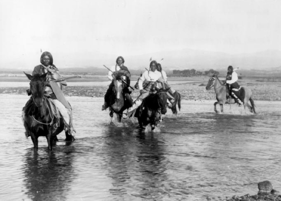
A shooting in the Old West I know was not much like the shootings on television today.  There was no glorification of the bad man. Killings were usually like the fatal shooting of Indian Tom on that 6th of September, 1906, in old Arrowhead (or Arrow).  Nobody called anybody out.  Nobody told anybody to draw or asked him if he was wearing a gun.  It wasn’t a fight. It was a killing.  

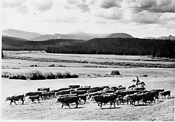
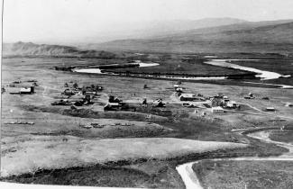
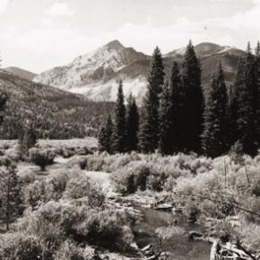
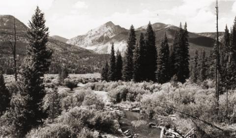
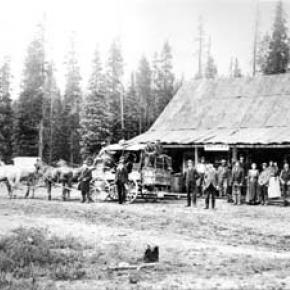
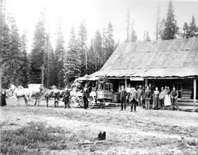
1906 Arrow had six saloons, a grocery store, one small hotel and a livery stable.  But two thousand people picked up their mail there.  The woods were full of tie-hacks: the three sawmills hired may lumberjacks and teamsters, most of them Swedes, who seemed to make the best lumbermen.   I had arrived in Arrow the 18th of April that year to work as a teamster for my brother Virgil, who had been operating a sawmill there for about a year.  I was just sixteen. 

My brother Dick, the tallest Lininger, had been Virgil’s foreman.  Virgil had also bought the only hotel in Arrow.  My mother, two sisters and my little brother Gilbert and I came from our farm in Osawatomie, Kansas, so that my mother could run the hotel. My brother Wesley came at that time too: he planned to buy a lot and build a café.  Whole families often followed the first member who had come to these early Colorado towns.   I soon discovered that driving logging horses needed a lot more technique than driving a small farm team, but Virgil was patient, and I soon received a raise to $2.75 a day as top teamster.  

 The town was a wide open as it could get.  My first introduction to the violence was the day my brother Dick fired three drunken lumberjacks.  They drew their pay and went to Graham’s saloon to get drunker. As dick passed the saloon later, one of the men grabbed a quart whiskey bottle, and ran out and struck Dick behind the ear, knocking him cold.  The three then proceeded to kick him around.  Dick’s roommate Charley came to my brother’s rescue.  When Dick came to, he started for the hotel.  Charley guessed what he was after and beat him to the six-shooter. “I’ll make sure you can taken them one at a time” Charley promised him.   I came along just as my brother knocked the pick from the pick handle.  Something was up! In less time than it takes to tell it, Dick had three drunks out cold. 

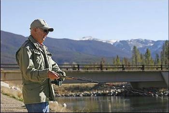
Mother patched Dick up.  I think this was her introduction, too.  A man couldn’t stay boss long if stayed whipped.   Every other Sunday was a holiday for me although I always saw to it that I put in enough overtime to bring my monthly paycheck to $75. That September Sunday I was dressed in my holiday garb – tan peg-top dress corduroys, light blue wool shirt, Western hat, and high-laces boots as befitting a teamster who drove four or six horses hauling logs from timber country to the saw mill.  When I drove six horses, I rode one of the wheel-team horses and held the lines over four.  If I drove four horses, I rode the wagon and sat on a sack of hay.  

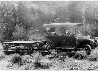
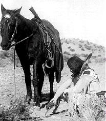
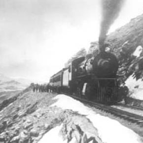
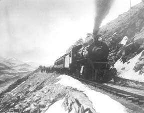
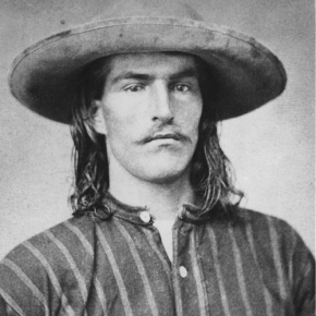
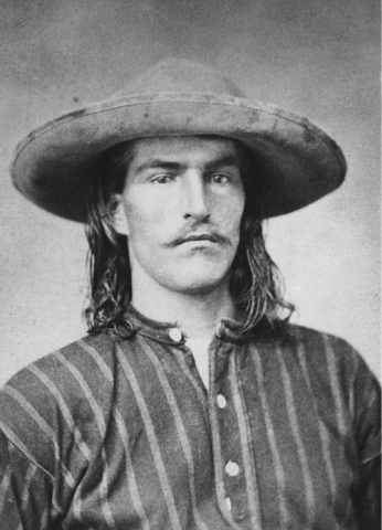
About noon, I stopped in front of the MacDonald saloon to talk to Ed MacDonald, one of the few saloon men my mother didn’t disapprove of.  After all, Ed had come to Colorado as a TB and couldn’t do heavy work; filling glasses over a bar was about the only light work in those old mountain towns.  Later Ed owned the famous MacDonald Ranch on the South Fork of the Grand Rover – now Colorado River- and managed boats on Monarch Lake just above his ranch.  He always served great dinners and good food.   While Ed and I were talking, Indian Tom rode up.  He was a flashy cowboy of the old school, a very good looking man with predominantly Indian features although he was only half Cherokee. When riding, Tom always wore leather chaps, spurs, and a big Stetson.  As wagon foreman for Orman and Crook, contractors for building the Moffat Road, he was a very important figure, for he had charge of all their wagons and teamsters.   The greeting between Ed and Tom was cordial. 

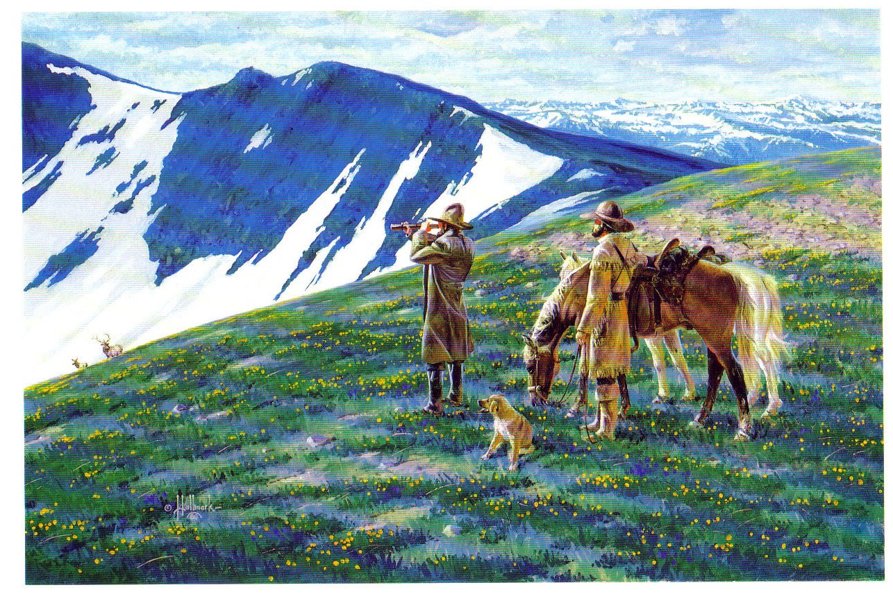
Everyone liked Indian Tom.  When Tom learned I was a teamster for my brother Virgil, Tom showed a much keener interest and invited me in to MacDonald’s for a drink.  Ed rescued me.  “Oh the kids doesn’t drink; but he might like a cigar”.   As they ordered drinks, I puffed away in my best imitation of a Kentucky colonel; however I soon excused myself, saying that I had to target my 30-30 rifle for the upcoming deer season. I puffed until I was out of sight. The corn silk I had scorched behind the barn paid off. I didn’t disgrace myself, nor had I broken my pledge to my mother not to gamble, use profanity, drink, or perform any act inconsistent with the conduct of a gentleman.   I took my rifle northwest of Arrow to Fawn Creek. 

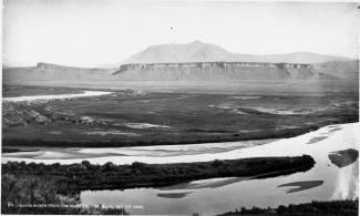
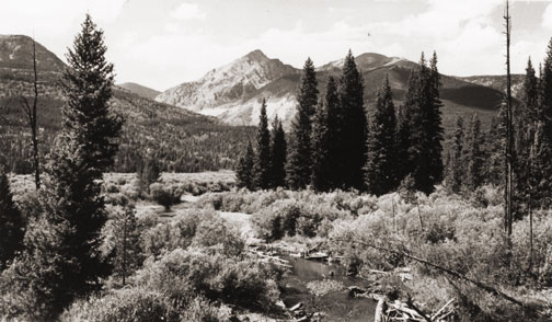
It was a beautiful fall day.  The aspen were just beginning to turn.  Fawn Creek Gulch had been burned over many years before by the Indians who hoped in this way to discourage settlers, and the aspen were all young, straight and shimmering in the way that has never ceased to delight me.  The fire thirty years before had made the gulch an excellent place for deer hunting because the new growth gave the deer some inviting protection, but the terrain was open enough for a hunter to locate his game.   I figured I’d have to shoot from at least 200 yards, so I planned to target for that distance.  I tacked a piece of cardboard I’d cut from my brother’s Stetson hat box (he never took off his Stetson off anyway) to a tree and stepped off the 200 yards.  That 6-inch target looked pretty small but after each three shots, I’d examine the target.  Finally satisfied, I took a long walk looking for deer sign, tracks, or droppings.  I found good sign but no droppings.   About feeding time for the horses, I went back to the barn in town to feed the four, Cap, the big bay, Bird, the glossy black (those were my two wheel horses- t e ones next to the wheel); Kate, the little lead horse; and Bud, her mate.  

Virgil had bought Kate, a grey mare weighing about 1400 pounds, at a very reasonable price from the Adams Express Company because she had run away at every opportunity and had destroyed several wagons.  He couldn’t run away now pulling Cap, Bird and a load of lumber with her, but her high spirits made her an excellent leader. The heavier team, always used as the wheel team, weighed about 1700 pounds each.   I was very proud of this unusually fine team.  Virgil had trained Cap and Bird so that after they were harnessed in the barn, they could be turned loose to go to the watering trough, drink long and thirstily, then walk out to the wagon, back into position by the tongue, and stand ready to have the breast straps snapped in place and the tongue attached.     When tourists trains stopped and hundreds of passengers stood around the eating places looking the town over, I’d drive slowly by, and then stop to rest the team a minute, to give the dudes a chance to see a good, four-horse team. Then with a single “Yup!” I’d pull all the lines tight, and they’d start as one horse while the tourists explained and pointed.  

That Sunday after I put a gallon of oats in their food box and shook some hay into their manger, I left the barn and started up the steps alongside the depot.  It was still light; the sky hadn’t even begun to color.   Time to head home for supper.  I’d have to be up, hitched and pulled by seven the next morning. We’d probably have roast beef or roast chicken with noodles, since it was Sunday.  Mother would be cooking on the big wood-burning stove at the hotel, and my sisters would be taking the heaping platters to the tables where everyone would pass them around.  Probably there would be hot biscuits.  

Suddenly a shot cracked just above me and across the street.  I knew instantly it had come from the Wolf Saloon ahead.  It wasn’t common to hear shots in those days.  You hear more in a 20-minute Western on TV than you heard in a couple of years unless a few boys rode into town on a Saturday night to shoot up the air.   I broke into a run and could see a man lying on the board walk in front of the saloon.  As I got to him, one of the ladies I wasn’t permitted to mention came out and fell to her knees beside him. Raising the man’s head, she tried to pour whiskey down his throat.  With a queer, paralyzed feeling, I realized it was Indian Tom.  I reached for his wrist.  His hand was warm as life, but there was no pulse. Several men ran our.  “Ragland got him!” one of them shouted.  

We carried Tom’s body into MacDonald’s and laid him on a roulette table that was in the back room for repair.  Somebody went to wire for the sheriff at Hot Sulphur Springs.  Word soon reached Orman and Crook’s, and the Indian’s many friends began to jam into Arrow.    Indian Tom and Ragland had evidently had words during the afternoon and had quarrels once more before at a rodeo.  The women from the saloon said that when Indian Tom left after the quarrel, Ragland had stationed himself, gun in hand, inside the saloon door.  Everyone agreed that Ragland knew he wouldn’t have had a chance in a fair fight with Tom.  The moment they heard Tom’s spurs outside , Ragland pushed the door slightly open and shot point blank through the aperture along the hinge.  The he ran out the back door.   We searched the town inside and out for Ragland. The sheriff joined is in the search late that night, but we found no trace of him.  Just after midnight a wire came for the sheriff. Ragland had turned himself in at Hot Sulphur.  We learned later he had run to a ranch down below, borrowed a horse and ridden for his life.   A coroner’s jury was called. 

My brother Virgil, named foreman, took a firm stand.  The only verdict he intended to take out of that room was murder, and, after only a few hours, that was their verdict.  After three days, Ragland was released on $3,000 bond posted by his father, but you may be sure he didn’t show himself around Arrow.  His attorney, John A. DeWeese, got a change of venue from Grand County to Jefferson County at Golden, claiming an article in the Middle Park Times of September 7, 1906, reporting the verdict of the coroner’s jury, made it impossible for Ragland to get a fair trial in Hot Sulphur.  The article said in part: Four witnesses for the prosecution, and seven for the Defendant were examined, making eleven in all.  The testimony of the witnesses on both sides failed to show that the shooting was justifiable.  According to the testimony, the fatal shot was fired when Reynolds (Tom) had his revolver in his scabbard and when he did not even see Ragland who was standing opposite the cut-off. (As told to Donna Geyer by A.W. Lininger)                     

Topic: Grand County

Grand County Trivia

After 1879 there were no Native Americans in Grand County.

In the 1800, the leading cause of death in Grand County was accidents followed by pneumonia.

Between 1887 and 1902, Grand County had no divorces.

The total resident population of Grand County in 1900 was 741.  The average life expectancy was 47 years.

Winters in Grand County often were severe, but nothing as terrible as the winter of 1898-1899.  Warm weather preceded the storm which began on February 2nd.  Four feet of snow fell by that first evening and the residents did not see the sun for the rest of the month as the snow continued to fall.  The snow continued into March and April and while few residents died, but the loss of livestock was tremendous.

Topic:

Ray Osborn

Article contributed by Tonya Bina 11-07


Ray Osborn's father, Elonzo Osborn was also an avid fisherman and hunter, and he and a neighbor stocked cutthroat trout the in the 1920s in the lakes in what is now Rocky Mountain National Park. This fact seems to bring pride to Osborn, who spent his entire adolescence exploring the terrain surrounding the upper Colorado River. "Everything in the outdoors was so ingrained in the way we lived," he said. "We lived in the outdoors, and we fished when we could and hunted when we could."

Osborn's maternal great grandfather is Warren Gregg, a settler and talented carpenter whose wife took the life of her young children, sparing two boys, in a story that has become legend in
Grand Lake. His maternal grandfather, Ray Gregg, was a blacksmith and a carpenter. He was also the justice of the peace in Grand Lake.

And Ray Osborn's father was a rancher, a man who was forced off of his land when a large water delivery system came to define the West Slope. Being fourth-generation
Grand County can be frustrating, he said. "There's too many changes. None of them for the better. Rich developers are coming in here and tearing the country up and developing the county. They don't care because they're not going to live here. They're going to get their money and go someplace else," he said. "I don't like all the changes now, they're destroying the natural beauty of Grand County."

Osborn, who had six brothers and sisters, has seen two of his childhood homes be torn down "for progress." The first was the ranch house his family lived in before the Bureau of Reclamation claimed his father's 54 acres for the Colorado-Big Thompson project. The ranch land is now a lake bed, 11 feet below the water's surface.
When Shadow Mountain Reservoir was drained last year to kill weed growth, Osborn said he could still see the old foundation. The government offered his father $5,400 for the 54 acres, take it or leave it.  "My father was broken-hearted over it because he loved to ranch."

With the money, Elonzo Osborn bought 11 acres on the north side of the North Fork of the Colorado, where he kept a milking cow and raised chickens, then went to work for the Bureau as a janitor at the government camps that sprung up for the construction of the project. Ray's mother went to work as a mail carrier, with a route from
Granby to Grand Lake up to Phantom Valley in the Park to supplement the family's income.

During WWII, the family raised rabbits during a meat shortage. "Rabbits were easy to raise, and we sold a lot of them," Osborn said. Ray Osborn attended first through ninth grade at the
Grand Lake primary school before attending Middle Park High School, which had just been built in 1947. There were 22 people in Osborn's class, and he was the first student to graduate mid-term from the new school. The very next day, he joined the Navy, the start of a 24-year career that involved two wars.
"On my first tour of duty, I came home on leave and went to a high school football game," Osborn said. It was there that Osborn met Mary Ann, who was visiting from
Iowa for a few months during her senior year in high school.

After a long-distance engagement, the couple married at St. Anne's Catholic Church in
Grand Lake in the fall. This September, they celebrated their 55th anniversary.
Most of his career was spent overseas, Osborn said, with more than 16 years in
Asia. He credits his wife for raising their four children mostly on her own. In 1973, he retired from the military; his youngest was 13 years old.

Upon retirement, after a stint in
Denver, the family relocated to Grand County, where Osborn worked at Winter Park Resort for 12 years. Nearly every day, Osborn heads to his favorite fishing spots, such as the canal that feeds into Shadow Mountain reservoir, a replacement of the river that once was.  He now brings his grandchildren fishing too, and grandma Mary Ann knows just how to cook up those brookies, "cornmeal and flower, olive oil in the pan, a sprinkle of lemon pepper" to make them taste real good. "Get them real brown," she says.

Osborn likes how much fun they are to catch, and his youngest grandson does too.
"They're like wild trout - you got to know how to fish for them in order to catch them," he said. It's when the 75 year-old outdoorsman is talking about the rivers, inlets and hills he knows so well, he seems most at home. "Not too many people left here that have been here longer," he said.


Topic:

Places in Grand County

Click on the drop-down menus and discover the history behind some of the everyday places you visit in Grand County.

Grand County was established in 1874 by the Territory of Colorado, thus becoming a county two years before Colorado became a state. It was named for the Grand River, the name by which the Colorado River was known at that time. 

The headwaters of the today's
Colorado River are in Grand County. The county was formed from a portion of Summit County but acquired its current boundaries in 1877, when part of the Grand County was used to create Routt County.

The county seat is Hot Sulphur Springs. The area of 1,854 square miles (larger than Rhode Island) consists of meadows, river valleys and mountains.

Sources:
R.C. Black,
Island in the Rockies. Pruett Publishing Company, 1969
William Bright,

Colorado Place
Names. Johnson Publishing Company, 1993
Hafen and Hafen, Our State:
Colorado. Old West Publishing Company, 1971

Error message

  • Notice: Undefined index: quantity in omega_views_mini_pager() (line 234 of /var/www/html/docroot/sites/all/themes/omega/omega/inc/theme.inc).
  • Notice: Undefined index: quantity in omega_views_mini_pager() (line 234 of /var/www/html/docroot/sites/all/themes/omega/omega/inc/theme.inc).

Regions